---
title: Let OroraTech Upload Your Monitoring Areas
description: Support on uploading your monitored areas
---
[Skip to content](https://help.ororatech.com/monitored-area-integration-support#main-content)
- [English](https://help.ororatech.com/monitored-area-integration-support)
- [Español](https://help.ororatech.com/es/monitored-area-integration-support)
English
Show submenu for translations
[](https://help.ororatech.com/?hsLang=en)
Open main navigation
Close main navigation
- - [English](https://help.ororatech.com/monitored-area-integration-support)
- [Español](https://help.ororatech.com/es/monitored-area-integration-support)
English
Show submenu for translations
- Wildfire Solution App
Wildfire Solution App
How can we help you?
- There are no suggestions because the search field is empty.
1. [Help Center](https://help.ororatech.com/?hsLang=en)
2. [Start Here](https://help.ororatech.com/start-here?hsLang=en)
3. [Get Ready to Monitor](https://help.ororatech.com/start-here?hsLang=en#get-ready-to-monitor)
# Let OroraTech Upload Your Monitoring Areas
## Want Support Uploading Your Monitoring Areas?
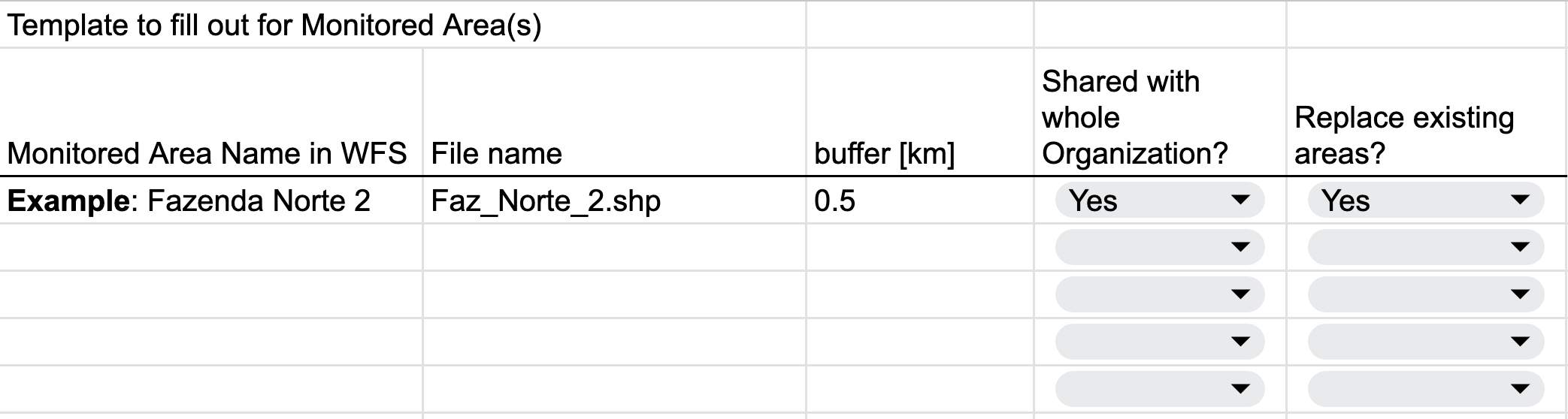
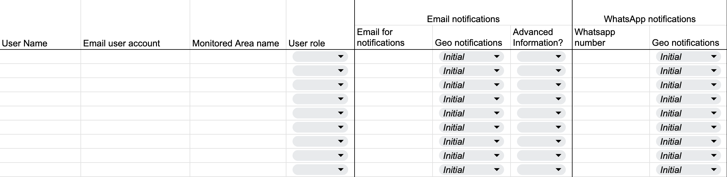
- The workflow will have a template to fill out ([download it here](https://help.ororatech.com/hubfs/Help%20Center%20files/Guideline%20template/Monitored%20Area%20integration%20template.xlsx?hsLang=en)⬇️)
- Send the template to either your contact person, or to support@ororatech.com
If you have red the Article [Set Up Monitored Areas & Sub-Areas Yourself](https://help.ororatech.com/integrating-areas?hsLang=en) and if:
- you encounter problems during the upload
- you have many areas to upload
- you need to handle buffering for several monitored areas that overlap
the Customer Success team can upload your Monitored areas for you - including buffers, format checks and notification settings.
What we need from you:
1. Geodata file(s)
1. Acceptable formats: **.geojson** or **.shp** + all necessary shapefile components
2. Sub-Areas (file properties) as rows, no null geometries!
3. Max file size: 100 MB per area
2. Filled out Template
1. Download Template
2. Fill both sheets (Fill out both sheets ("Monitored Area" and "User Selection")
- We recommend to have no more then 5 separate monitored areas.
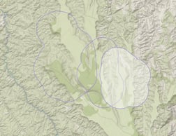
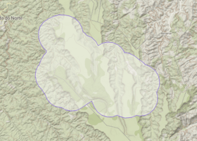
- If separate monitored areas are spatially too close together or intersecting after the buffering (left image), please merge them into one file before sending them (right image).
- In case of already existing Monitored areas, please decide if new areas should complement existing areas or replace them.
---
### Data Format
- Possible file formats: Geojson(.geojson) and Shapefile( .shp, .dbf, .prj, .shx)
- Several sub-areas can be included as a row in the file
- Unified coordinate system for all files (e.g. EPSG 4326, or local coordinate system)
- Attribute table with id column or name column, no null values!
- Other values/columns for subarea properties (region name, area, land cover class)
- File naming and attributes without special characters like mutated vowel (ê, ã, é, ñ )
- File naming and folders without spaces, instead use underscore
- File size per Monitored Area can not exceed 100 megabyte
- Features need to be valid polygons and not null (check validity!)
- Have a maximum number of subareas per monitored area no larger than 2000. If
more subareas are needed, additional costs might be incurred due to increased
operational effort.
---
#### Structure of the Monitored Area
Please fill out this [Template](https://help.ororatech.com/hubfs/Help%20Center%20files/Guideline%20template/Monitored%20Area%20integration%20template.xlsx?hsLang=en) for answering the following questions in the first sheet *"Fill out Monitored Area"*:
- Buffer for each MA in kilometers
- If and which Monitored Areas are shared throughout the organization?
- Are the new monitored areas replacing the old areas or are these additional areas?
---
### User structure
Please fill out the second sheet of the template *"User selection and notifications"*
- Please provide a list of each user who should get access to the platform or already has access (including name, Email, and phone number for notifications)
- If number is provided, shall notifications be sent via SMS or WhatsApp?
- Specify which user should see/control what zone
- Which user/s should get Admin rights? (remove/edit other users)
**After filling out the template, please send it to your responsible Customer Success contact.**
---
### Notifications
Different notifications settings are available for Email, WhatsApp and SMS.
Geostationary (GEO) and Low Earth Orbit Satellite detections (LEO):
- **Option 1 Default for integration:** Only GEO detections until validated by LEO detections, then GEO notifications turn off
- **Option 2**: Only LEO detection notifications
💡 We recommend using the default option 1. If you still wish to have option 2, please indicate in the attached template.
- [Start Here](https://help.ororatech.com/start-here?hsLang=en#main-content)
- [Explore WFS](https://help.ororatech.com/start-here?hsLang=en#explore-wfs)
- [Get Ready to Monitor](https://help.ororatech.com/start-here?hsLang=en#get-ready-to-monitor)
- [Learn the Basics](https://help.ororatech.com/learn-the-basics?hsLang=en#main-content)
- [Detections: Hotspots & Clusters](https://help.ororatech.com/learn-the-basics?hsLang=en#detections-hotspots-clusters)
- [Understand Fire Data](https://help.ororatech.com/learn-the-basics?hsLang=en#understand-fire-data)
- [Dive Deeper: Satellites & Fire Data](https://help.ororatech.com/learn-the-basics?hsLang=en#dive-deeper-satellites-fire-data)
- [Detect, Monitor & Analyze Fires](https://help.ororatech.com/detect-monitor-analyze-fires?hsLang=en#main-content)
- [Monitor & Assess Fire Activity](https://help.ororatech.com/detect-monitor-analyze-fires?hsLang=en#monitor-assess-fire-activity)
- [Fire Spread](https://help.ororatech.com/detect-monitor-analyze-fires?hsLang=en#fire-spread)
- [Burnt Areas & Data Analysis](https://help.ororatech.com/detect-monitor-analyze-fires?hsLang=en#burnt-areas-data-analysis)
- [Notifications](https://help.ororatech.com/detect-monitor-analyze-fires?hsLang=en#notifications)
- [Account & Settings](https://help.ororatech.com/detect-monitor-analyze-fires?hsLang=en#account-settings)
- [Additional Knowledge](https://help.ororatech.com/detect-monitor-analyze-fires?hsLang=en#additional-knowledge)
- [Integrations & Advanced Setup](https://help.ororatech.com/integrations-advanced-setup?hsLang=en)
- [Product Updates](https://help.ororatech.com/product-updates?hsLang=en)
- [Academy & Tutorials](https://help.ororatech.com/academy-tutorials?hsLang=en)
- [During an Active Fire](https://help.ororatech.com/during-an-active-fire?hsLang=en)
- [The Science Behind WFS](https://help.ororatech.com/the-science-behind-wfs?hsLang=en)
[](https://ororatech.com/)
[mailto:email@email.com](mailto:email@email.com)
Copyright © 2026, OroraTech